
Ireland's public transport works. Finding out when it is coming is the part that has always been scattered: one app for the train, another for the Luas, a website for the bus, and nothing at all for the bikes. TFI Coverage Map puts all four on one screen, live, and delivers verified real-time tracking, schedule reconciliation, and physical stop infrastructure data.
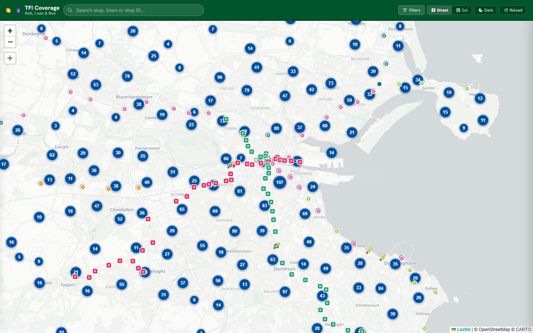
The Fragmented Transit Discovery Problem
In modern metropolitan transit networks, commuters rarely rely on a single mode of travel. A typical daily journey across Dublin involves walking from a bus stop, transiting through a mainline rail station concourse, transferring to a Luas light rail tram, and unlocking a municipal shared bike for the final mile.
Historically, each network operated its own dedicated application and proprietary data silo. This created severe operational friction: travelers were forced to switch between multiple disconnected interfaces, reconcile conflicting arrival predictions, and guess whether physical interchange points were accessible.
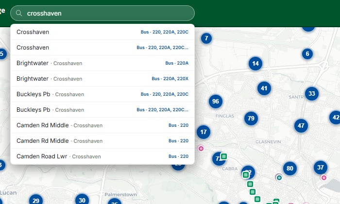
Search Doesn't Care Which Operator You Meant
Type a stop name, a town, or a stop ID, and the results come back unified: rail, Luas, bus, and bike stations ranked together by spatial relevance and exact identifier matches. Search for "Heuston" and you get the mainline rail terminal, both Luas platforms, the perimeter bus stops, and the two bike docks across the bridge, all in one list.
The application treats interchange nodes as single physical hubs rather than four separate operator silos, using spatial R-tree indexing to cluster multi-modal platforms within walking proximity.
One List, Sorted By When It Actually Arrives
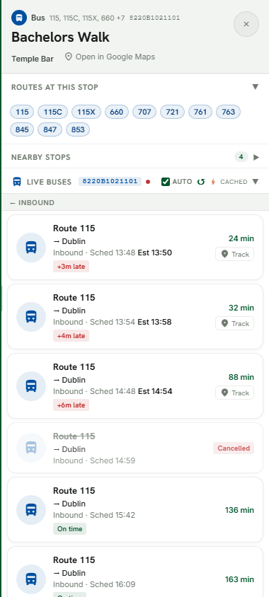
Open a stop and you receive every vehicle due there in a single list ordered strictly by arrival time, not fragmented by direction or isolated by sub-contractor. A live-tracked bus and a scheduled timetable departure sit side by side, exactly where they belong in the sequence.
The only distinguishing factor is a subtle Sched tag for scheduled-only runs. Real-time indicators (GPS positions, active delay counters, "Due now" statuses, and live tracking follow buttons) appear only when backed by authenticated GTFS-Realtime feeds. No artificial precision on static timetables, and no static padding on real-time movements.
Watch the Bus Actually Move
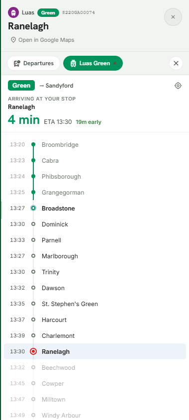
Tapping Track on any live departure places the vehicle directly on the map, displaying real-time coordinate position, heading bearing, and a precision timestamp (e.g. "Updated 18s ago"). The vehicle moves smoothly along its true geometric polyline, rather than connecting stops with straight imaginary lines.
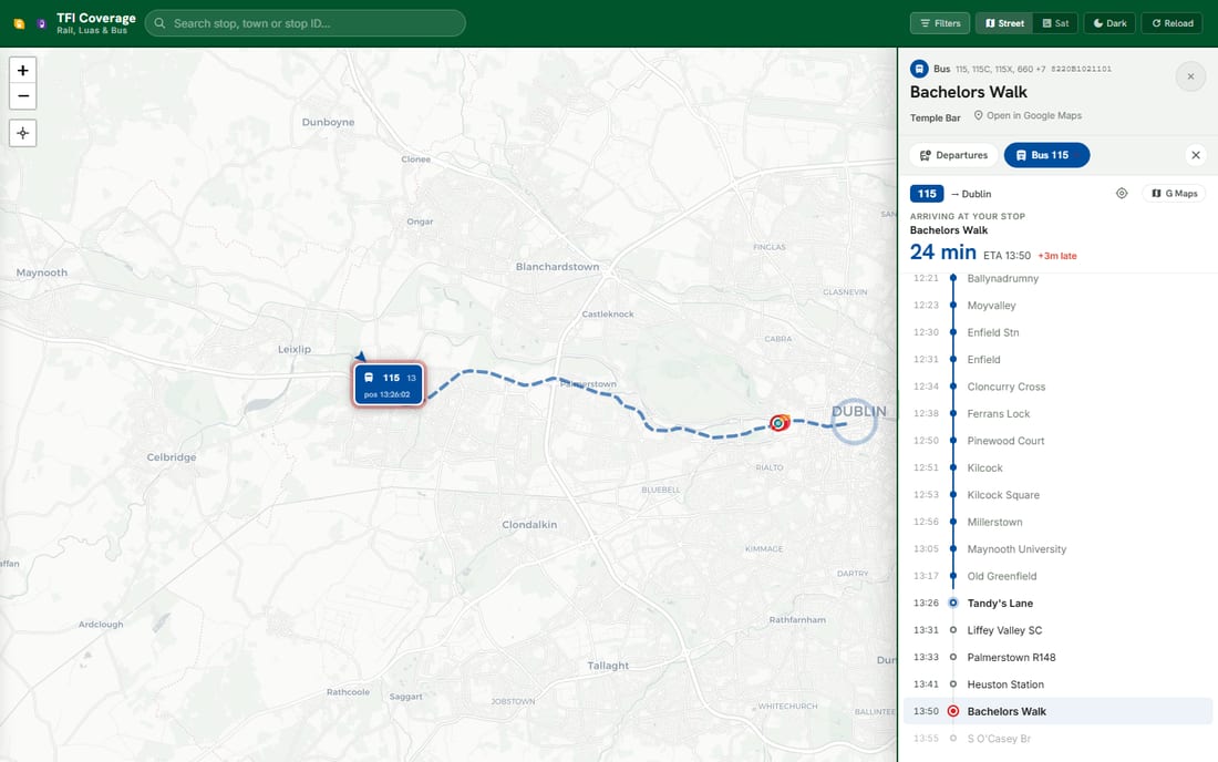
The tracking view simultaneously renders the full remaining stop sequence with timetable offsets. The target waiting stop is pinned and highlighted in the scroll, providing complete verification of how many stops remain and how much variance against schedule has accumulated.
Arrivals and Departures, Actually Split
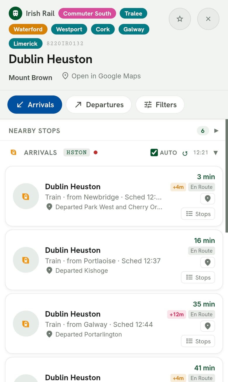
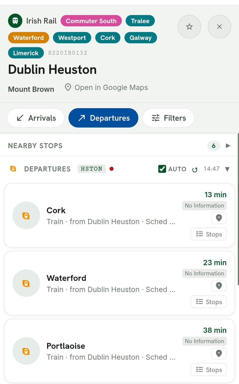
At mainline rail stations, "departures" and "arrivals" are not the same list read from opposite directions. Treating a major terminus like Heuston, Connolly, or Cork Kent as an undifferentiated display leaves a fundamental question unanswered: is my incoming connection arriving on time?
The interface divides rail boards into dedicated operational views:
- Departures Board: Originating or passing outbound services with destination, platform allocation, and departure clearance.
- Arrivals Board: Terminating inbound services tagged with origin terminal, estimated platform arrival, and upstream delay propagation calculated across preceding signal sectors.
What's Actually Standing At the Stop
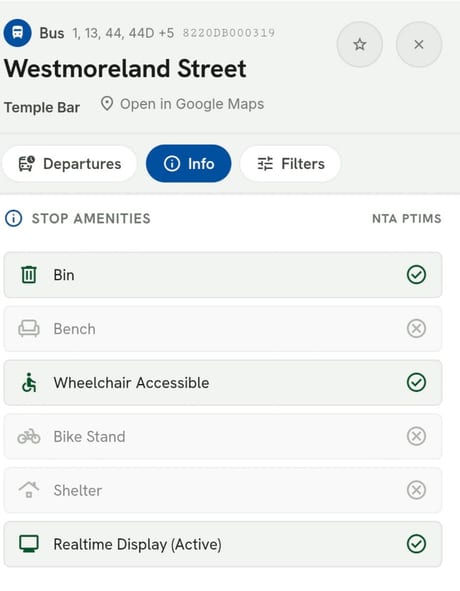
Timetables indicate timing, but fail to report physical realities: whether a stop has a shelter during rain, a bench, a bin, a bike stand, or real-time passenger information displays. Crucially, traditional maps have consistently lacked reliable wheelchair accessibility indicators.
By integrating the National Transport Authority's national stop-infrastructure survey into the data pipeline, every stop displays an instant physical amenity profile. A dedicated accessibility filter allows travelers with reduced mobility to display only audited accessible stops and platforms.
Dublin Bikes and Regional Bikeshare, in the Same Spatial Context
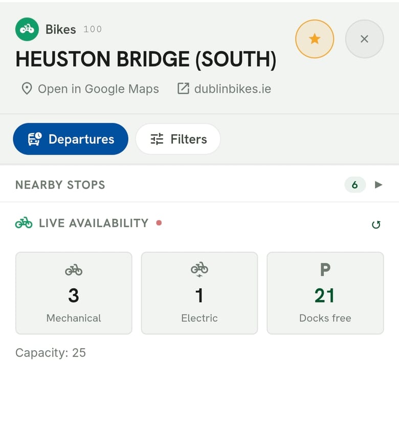
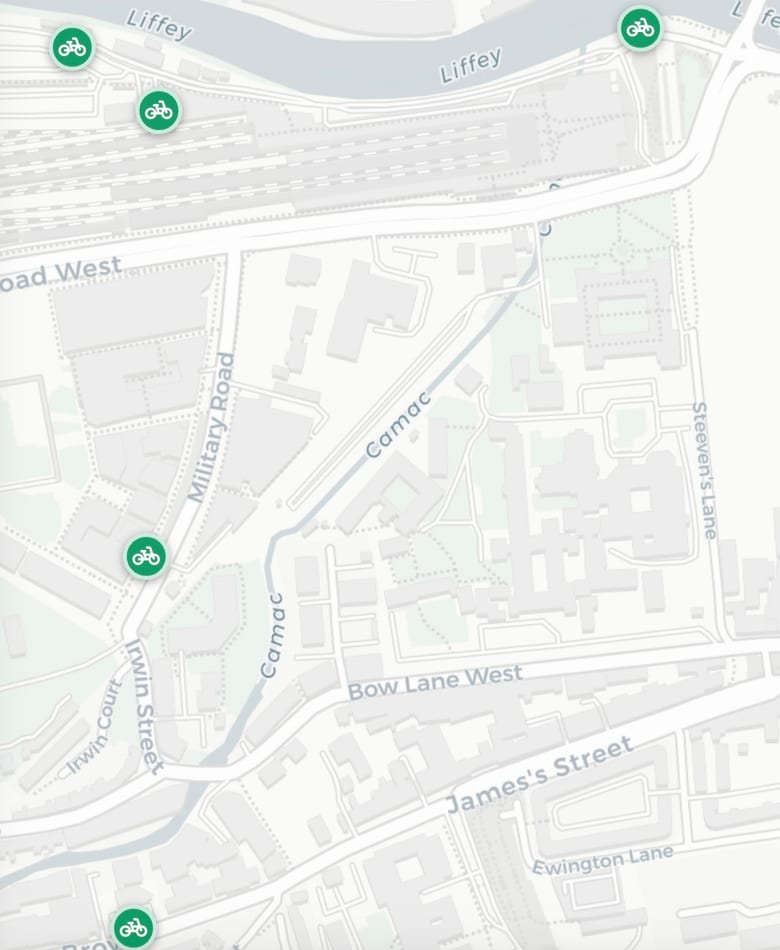
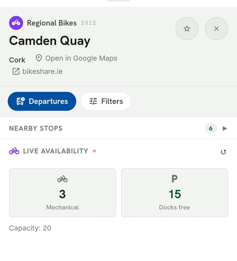
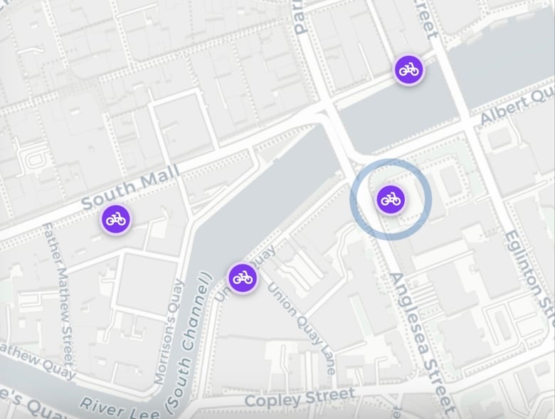
Bike share schemes have historically operated within dedicated walled-garden applications, and Ireland runs more than one of them: Dublin Bikes in the capital, and a separate regional bikeshare network in cities like Cork. In TFI Coverage Map, every dock from either scheme is integrated directly into the unified map canvas. Tapping a station reveals live stock, separating standard mechanical bikes from e-bikes, refreshed automatically via public GBFS endpoints.
Stations use instantaneous color-coded availability thresholds: clear warnings when docks are empty or completely full, and clean green indicators when stock is balanced, saving unnecessary walking time.
Digital Ticket to Google Wallet Pass
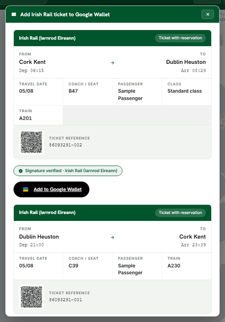
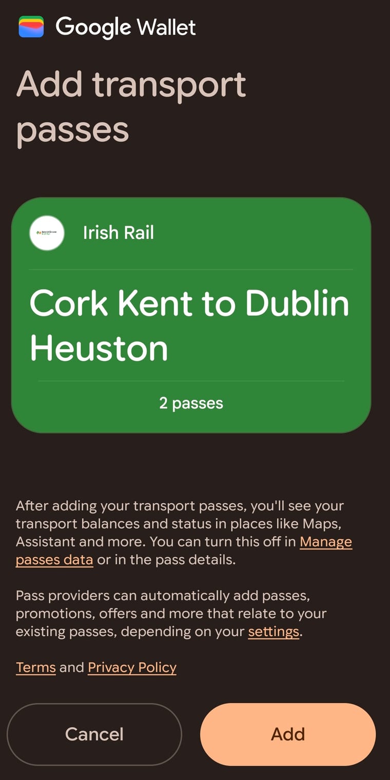
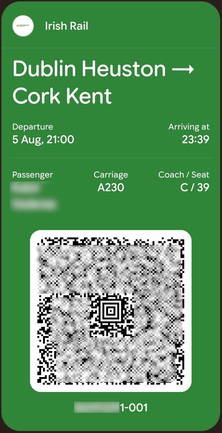
Irish Rail e-tickets are issued as PDF files, which create friction at station turnstiles with poor network coverage or awkward zoom requirements. The application incorporates a zero-storage pass converter: feeding a booking PDF into the wallet tool generates a native Google Wallet pass with a high-contrast Aztec / QR code that displays seamlessly on lock screens.
The conversion occurs ephemerally in server memory: the ticket barcode payload is decoded, packaged into the signed pass container, and the source PDF is immediately purged without persisting passenger identifiers or travel logs.
Data Pipeline & Performance Architecture
Building a high-frequency transit application requires strict discipline regarding data lifecycles, separating slow-moving scheduled network topologies from high-throughput real-time telemetry:
Production Impact & Key Takeaways
By uniting disjointed operator feeds into a single coherent spatial model, TFI Coverage Map demonstrates that transit discovery does not require heavy framework bloat or invasive user tracking. Key architectural principles proven by this system include:
- Sub-50ms Global Query Latency: Pre-compiled spatial lookups avoid costly database joins on high-frequency mobile requests.
- Zero False Precision: Explicit separation between static timetable estimates and verified real-time GPS telemetry maintains passenger trust.
- Privacy by Design: Zero passenger travel history or ticket payloads are retained in persistent storage.
Disclaimer: TFI Coverage Map utilises open data published by the National Transport Authority (NTA) and Dublin City Council under open government licences. It is an independent architecture showcase developed by Vaderaa Consulting and is not an official product of the NTA or Transport for Ireland.